MLOps overview
MLOps overview#
Authors: Sam Budd, Gonzalo Mateo-García
The MLOps section have tutorials for training, testing and running inference of flood extent segmentation models for Sentinel-2.
Models are trained in the WorldFloods[1] dataset which is freely accessible at gs://ml4cc_data_lake/2_PROD/2_Mart/worldfloods_v1_0/.
Each of the tutorials is self-contained and can be run on Google Colab.
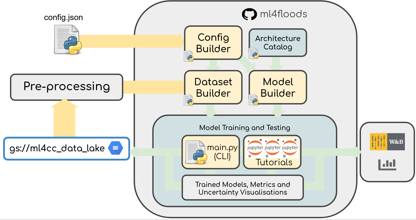
Content:
Train models: trains the WorldFloods model on the WorldFloods dataset from scratch

Model metrics: loads a worldfloods trained model and run inference on all images of the WorldFloods test dataset. It computes displays some standard metrics and the PR and ROC curves for water detection.
Inference on Sentinel-2 images: loads a worldfloods pretrained model and runs inference on a Sentinel-2 image from the WorldFloods dataset. It shows the predictions vs the ground truth on that image.
Probabilistic Neural Networks: Run inference of the U-Nets trained with dropout. We apply Bayesian dropout at inference time to obtain an ensemble of predictions.
Cloud removal inference: Run inference of the multioutput binary classification model. This model is able to predict land/water under the clouds.
Inference on time series of Sentinel-2 images: Download a time series of Sentinel-2 images over an area of interest and run inference on them.
Inference on Sentinel-2 SAFE files: Download Sentinel-2 images from Copernicus Open Hub over an area of interest and run inference on them.
[1] Mateo-Garcia, G. et al. Towards global flood mapping onboard low cost satellites with machine learning. Scientific Reports 11, 7249 (2021).